|
Geospatial and Environmental Analysis
College of Natural Resources and Environment
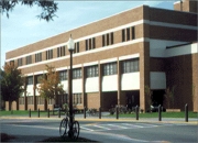
Wallace Hall, an academic building on West Campus Drive, contains classrooms, offices, and laboratories that support various departments in the College of Liberal Arts and Human Sciences. The original building, constructed of red brick like adjacent Hillcrest Hall, was under construction in 1966 and was occupied in January, 1969. Named for Maude E. Wallace, state home demonstration agent 1929-38; assistant director of Extension 1938-59.
|
Department of Geography, 238 Wallace Hall, 0115, Mail Code:0115 Blacksburg VA 24061
|
|
|
|
Department Chair : Thomas Crawford
Graduate Program Director : Yang Shao (Associate Professor)
Professors:
Thomas Crawford;
Andrew Ellis;
Korine Kolivras;
Lynn Resler;
Randolph Wynne
Associate Professors:
Timothy Baird;
Zachary Easton;
John Galbraith;
Luke Juran;
Marcella Kelly;
Lisa Kennedy;
Kevin McGuire;
Robert Oliver;
Thomas Pingel;
Yang Shao;
Valerie Thomas
Assistant Professors:
Megan O'Rourke;
Meredith Steele;
Stephanie Zick
Research Professors:
William Ford;
Jeffrey Marion
Geospatial and Environmental Analysis Introduction
The interdisciplinary doctoral program in Geospatial and Environmental Analysis focuses on the application of geospatial analysis for improving the science, management, and conservation of natural resources and the environment. Based in the College of Natural Resources and Environment, the program draws upon the expertise of faculty from the Departments of Forest Resources and Environmental Conservation, Geography, Fisheries and Wildlife Sciences, and Sustainable Biomaterials, as well as from those in departments in other colleges, including Crop and Soil Environmental Sciences, Civil and Environmental Engineering, and Biological Systems Engineering.
Geospatial research involves Geographic Information Systems (GIS), the Global Positioning System (GPS), remote sensing, and imagery analysis. Environmental analysis focuses on the complex interactions among people, nonhuman biota, and environmental conditions. This doctoral program combines cutting-edge training and research in the theory and application of geospatial science with environmental analysis to enhance research on a broad range of contemporary natural resource and environmental issues. Graduates will be prepared for careers in higher education, government, research, and industry.
Complete Program Description
A complete program description and our program guidelines are found here.
Offered In (Blacksburg)
Degree Requirements
Minimum GPA: 3.2
Institution code: 5859
Testing Requirements:
- GRE
- General Test
-
Verbal
:
153.0
-
Quantitative
:
156.0
-
Analytical Writing
:
4.0
Students must complete 90 credit hours and a dissertation that involves original research. The program has three areas of required coursework totaling 31 credits. The first is composed of required Core Courses consisting of:
-
14 hours of classes that provide training in advanced research techniques, statistical and spatial analysis, ethics, diversity and inclusion training, and discussion of contemporary issues in GIS and remote sensing.
-
12 hours of electives in geospatial classes involving both GIS and remote sensing.
-
6 hours of classes from electives in environmental analysis. Students must also complete a minimum of 30 hours of Research and Dissertation and 29 hours of other coursework and/or additional hours of Research and Dissertation.
Students can transfer all approved graduate coursework taken at Virginia Tech prior to enrolling in this program and up to 15 hours of coursework from another university.
|
|
|
|
|
Geospatial and Environmental Analysis Facilities Introduction
The program has a wide range of facilities necessary for advanced training in geospatial and environmental analysis, including state-of-the art labs for GIS and for biogeography (for the study of recent and long-term environmental history and vegetation change).
The Center for Environmental Applications of Remote Sensing (CEARS), housed in the College of Natural Resources and Environment, is a world-class geospatial research facility established in 1997 as a NASA center of excellence in applications of remote sensing to regional and global integrated environmental assessments. With core faculty in both the Geography and Forest Resources and Environmental Conservation departments, it is Virginia Tech's focal point for interdisciplinary research, instruction, and outreach focused on remote sensing applications. Doctoral candidates in this program will have the opportunity to interact with CEARS researchers who have extensive expertise with a wide variety of data types (including active and passive microwave, multispectral, hyperspectral, lidar, aerial photographs) and application areas (such as temperate and tropical forestry, limnology, ecological modeling, marine biology, environmental monitoring, urban ecology, carbon sequestration, tropical biodiversity assessment, phenology studies, rangeland management, invasive species, and fire fuel loading).
Facilities, Equipment, and Other Resources
Facilities, Equipment, and Other Resources
Principal resources and facilities available to GEA students include those in student departments and within the College's Center for Environmental Applications of Remote Sensing (CEARS). Below are those within the Department of Geography and CEARS.
Geography Department Lab:
Hardware: 33 Dell Precision 3630
Processor: INTEL 6 Core I7 at 3.2 Ghz
Ram: 32 GB per system
Internal Storage: 1 Tb solid state
GPU: NVIDIA GeForce GTX 1060 with 6 Gb VRAM
Periperals: HP Designjet T730 large format printer
Relevant Software's: complete suite of image processing (ENVI, ERDAS Imagine) and associated software, including compilers (IDL, Absoft Fortran, Matlab, Visual Studio, Python), statistical packages (R, SAS), and GIS (ESRI products).
College of Natural Resources and Environment, Center for Environmental Applications of Remote Sensing (CEARS) Lab:
Hardware: 22 networked (1 Gbit) Precision Workstations (15 - Quad core Xeon with 64 Gb ram, 7 - Six core Xeon with 128 Gb ram)
Internal Storage: 3 Tb
Peripherals: HP Designjet T730 large format printer
Relevant Software: complete suite of image processing (ENVI, ERDAS Imagine) and associated software, including compilers (IDL, Absoft Fortran, Matlab, Visual Studio, Python), statistical packages (R, SAS), and GIS (ESRI products).
GPS equipment available:
4 Trimble GeoXT
18 Garmin Etrex
Meteorological Equipment:
3 ea Campbell Scientific mobile metrological units: RM Young wind monitor, CSL
Temperature/RH probe, Sentra 278 Barometer, Garmin GPS receiver, CR800-ST-SWNC
Measurement & Control Datalogger
Handheld Field Spectrometer:
ASD PANalytical FieldSpec Handheld 2 Field Spectrometer, 325-1075nm. w/wforeoptics and Rad.Cal.
|
|