|
Remote Sensing
Interdisciplinary Academic Programs
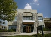
The first phase of Cheatham Hall was built in 1972, to provide new classroom, laboratory, and office space for Forestry and Wildlife Resources, then a division of the College of Agriculture and Life Sciences. Constructed at a cost of $1,670,000, the building offered 56,010 square feet of spacious classrooms and offices, all of which boasted paneled walls of different species donated by forest industry companies. The building was dedicated on May 5, 1972.
|
Remote Sensing IGEP (MC0324)
Virginia Polytechnic Institute and State University
Cheatham Hall, RM 319
310 West Campus Dr Blacksburg VA 24061
|
|
|
|
Program Director : Randolph Wynne
Graduate Program Director(s) : Stacey Kuhar,
Amy Cole
Professors:
Amos Abbott;
Joseph Baker;
William Hession;
Richard Hirsh;
Eric Patterson;
John Ruohoniemi;
Valerie Thomas;
Layne Watson;
Randolph Wynne
Associate Professors:
Scott Bailey;
Xinwei Deng;
Saul Halfon;
Kevin Kochersberger;
Klaus Moeltner;
Yang Shao;
Manoochehr Shirzaei;
Venkataramana Sridhar;
Robert Thomas
Assistant Professors:
George Allen;
Elinor Benami;
Rebecca Cockrum;
Anuj Karpatne
Virginia Tech National Security Institute:
Eric Patterson
Research Assistant Professors:
Bharat Simha Reddy Kunduri
Remote Sensing
Remote sensing provides technical and methodological approaches to holistically study human activities that have an impact on the Earth’s physical processes. Ever-increasing natural and anthropogenic influences on the earth system necessitate the formation of a cadre of scientists well-trained to fully exploit the terabytes of information available daily from air- and space-borne sensors. While the information resulting from analysis of these data is, by itself, policy relevant, only by combining the information available from remote sensing with the knowledge, approaches, and analytical tools of the social sciences can complex issues at the interface of science and society be addressed. Further, remote sensing itself engenders a variety of social and policy questions, ranging from personal privacy to the social and cultural change that inevitably results from the wide adoption of transforming technology.
The goal of this program is to provide fully integrated educational experiences that will strengthen and enhance the ability of our graduates to address interdisciplinary challenges facing remote sensing scientists in today’s workplace. We do this by incorporating all aspects of remote sensing, including science, engineering, theory, data analysis, applications, and policy.
Our internationally-recognized faculty members span 5 colleges and 13 departments at Virginia Tech:
College of Engineering
-
Aerospace and Ocean Engineering (AOE)
-
Biological Systems Engineering (BSE)
-
Computer Science (CS)
-
Electrical and Computer Engineering (ECE)
-
Mechanical Engineering (ME)
College of Natural Resources and Environment
-
Forest Resources and Environmental Conservation (FREC)
-
Geography (GEOG)
College of Agriculture and Life Sciences
-
Agricultural and Applied Economics (AAEC)
-
Biological Systems Engineering (BSE)
College of Liberal Arts and Human Sciences
-
History (HIST)
-
Science and Technology Studies (STS)
College of Science
- Geosciences (GEOS)
- Biological Sciences (BIOL)
Offered In (Blacksburg)
Degree Requirements
Minimum GPA: 3.0
Institution code: 5859
Testing Requirements:
- GRE
- General
-
Verbal
:
-
Quantitative
:
-
Analytical
:
The Interdisciplinary Graduate Education Program in Remote Sensing requires all students to be accepted by and enrolled in a home program in one of the following core participating departments/programs (colleges in parentheses):
- Aerospace and Ocean Engineering (Engineering)
- Agricultural and Applied Economics (Agriculture and Life Sciences)
- Biological Sciences (Science)
- Biological Systems Engineering (Agriculture and Life Sciences, Engineering)
- Computer Science (Engineering)
- Electrical and Computer Engineering (Engineering)
- Forest Resources and Environmental Conservation (Natural Resources and Environment)
- Geosciences (Science)
- Geospatial and Environmental Analysis (Natural Resources and Environment)
- Mechanical Engineering (Engineering)
- Science and Technology Studies (Liberal Arts and Human Sciences)
- Statistics (Science)
It is essential that students applying to the Remote Sensing IGEP designate their desired home program on their application so that the materials can be appropriately routed for joint evaluation.
In addition to participating in IGEP-specific events and meetings, enrolled students must meet all requirements of their home program and the Remote Sensing Certificate, plus enroll in either GRAD 5134 (Interdisciplinary Research in Remote Sensing) or the Interdisciplinary Seminar in Remote Sensing (FOR/GEOG 5104 or equivalent) if offered, each semester in which they are enrolled on campus.
A lab exchange is required, either on- or off-campus. Most students elect the off-campus option with federal scientists at a national lab, NASA Center, or other agencies.
Co-chairing of advisory committees is considered to be the norm; exceptions must be granted by the program director in consultation with the major professor and home department.
|
|
|
|
|
Remote Sensing
---
Advanced Research Computing
Advanced Research Computing (ARC) delivers a comprehensive ecosystem consisting of advanced computational systems, large-scale data storage, visualization facilities, software, and consulting services.
Center for Environmental Analytics and Remote Sensing
The CEARS laboratory is equipped with 22 networked (1 Gbit) precision workstations (15 Quad core Xeon with 64 Gb ram, 7 Six core Xeon with 128 Gb ram) a high end large format printer, and a complete suite of image processing (ENVI, ERDAS Imagine) and associated software, including compilers (IDL, Fortran), numerical scripting environments (Matlab, Julia, Python), statistical packages (R, SAS, Minitab, Salford Predictive Miner), structure from motion photogrammetric processing (DroneDeploy, Pix4D) and GIS (QGIS and ESRI products). There is over 100 TB of local networked attached storage (backed up daily).
Capability for measuring and integrating in situ and unmanned airborne measurements is provided by UAS lidar (YellowScan; joint with BSE), full range ASD spectroradiometers, roving GPS base stations, and a wide variety of commercial off the shelf sUASs.
Space@VT
Space@VT focuses on research investigations of the science, technological impact, and utilization of the geo-space environment. The goal of Space@VT is to develop a holistic approach to such research utilizing theoretical and advanced computational modeling as well as the development of scientific instruments and space missions for experimental data acquisition and analysis. Research Facilites
-
Global Navigation Satellite System GNSS Laboratory
-
Space Systems Simulation Laboratory
-
Aeronomy/Remote Sensing Laboratory
-
Advanced Space Computation Laboratory
-
SuperDARN Space Weather Radar Facility
-
Space Plasma Chamber
|
|